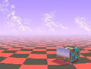
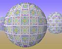
TerrainExcept for "Evening's Empire" and "Hybrid #3", the "terrain" images were developed using algorithms which lay out 3-D surfaces in a grid of triangles. The triangle size varies according to how close they are to the viewer; this helps reduce computing time."Evening's Empire" and "Hybrid #3" represent a new generation of algorithms, using higher-resolution refinement techniques. A fractal generator with a randomizing element created the clouds. The 3-D effect is enhanced by an atmospheric "haze" routine which mimics the effects of distance on the Earth's surface. Some of the designs on this page utilized the symmetry program to create the patterned components of the 3-D landscape. The "terrain" surfaces are based on various trig functions using the x-y plane as a domain. The ones which have high points or peaks use an additional multiplier: assume a compound trig function F(x, y). Additionally, suppose you want a peak at the point (p, q) in the plane. Let G(x, y)=c/[k+(x - p)2+(y - q) 2]½ where c and k are constants chosen to control the height and steepness, respectively, of the peak. Then the combined function F(x, y)·G(x, y) will superimpose the peak over the undulations of the trig function. |
|


